Snow, rain, wind, and sun, all within an hour is enough to give the squirrels whiplash. However, there are clear scientific reasons behind these rapid changes.
Snowfall is one of the most unpredictable aspects of winter weather. One night, heavy snow blankets the ground, only for it to melt the next day, followed by another round of fresh snowfall. This constant fluctuation can be frustrating for those hoping for a stable winter landscape, especially in the Seattle area.
For snow to form, specific atmospheric conditions must align. Snow develops when moisture in the air condenses and freezes into ice crystals at temperatures at or below 32°F (0°C). These ice crystals then cluster together to create snowflakes, which fall when they become heavy enough.
The temperature near the surface is equally important. If it remains at or below freezing, the snow will accumulate. However, if temperatures rise above this threshold, the snow may melt before reaching the ground, turning into sleet or rain instead.
One of the main reasons snow doesn’t always stick around is temperature fluctuation. While it may be cold enough for snow to fall at night, daytime temperatures can rise above freezing, causing it to melt.
Sunlight also plays a role—even on cold days, direct sunlight can warm the ground and speed up the melting process. Additionally, if the ground was relatively warm before the snowfall, the snow may not accumulate as effectively, leading to rapid melting once temperatures rise.
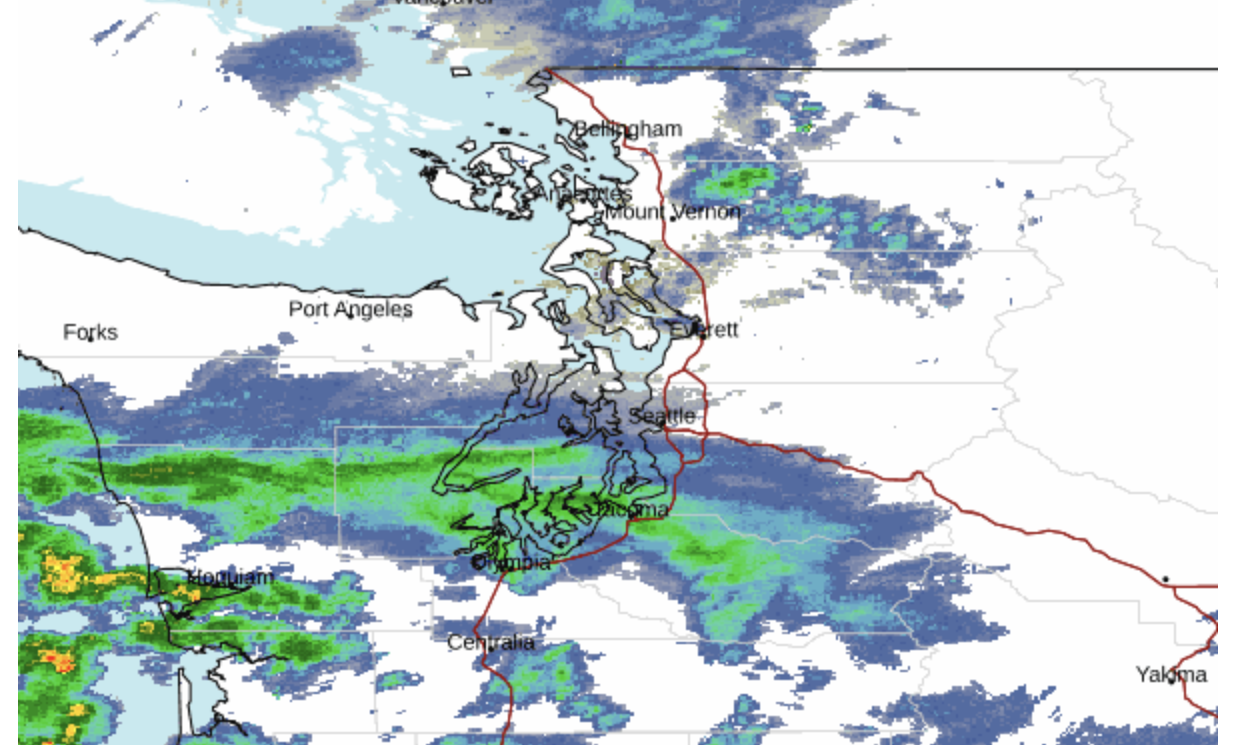
Washington state, particularly Seattle, has seen significant fluctuations in snowfall recently. In the past week, Seattle experienced mixed rain and snow, with light accumulations followed by rapid melting due to slightly above-freezing daytime temperatures. While some areas, like South King County, saw more persistent snow coverage, much of the snowfall quickly turned slushy or disappeared entirely.
These variations are driven by shifting air masses and the region’s coastal influence, which keeps temperatures relatively mild. Forecasts indicate continued chances of snow showers, highlighting the unpredictable nature of winter weather in the Pacific Northwest Newsweek.
Winter weather is in constant flux due to the movement of air masses. A cold front bringing snow can quickly be replaced by a warm front, leading to melting conditions. Conversely, a return to colder temperatures may result in another round of snowfall. Wind patterns and humidity levels also impact how long snow lasts. Dry, cold air helps preserve snow, while warm, moist air speeds up melting.
The type of precipitation also affects how snow behaves. In some cases, snowfall mixes with rain or sleet, which makes the snowpack denser and more likely to melt quickly. Freezing rain, which occurs when raindrops freeze upon contact with a cold surface, can also contribute to a temporary layer of ice that accelerates melting once temperatures rise.
Ultimately, the fluctuation of snow is due to the constantly changing nature of the atmosphere. Because temperature, air pressure, humidity, and wind patterns are always shifting, snow rarely remains consistent for long periods.
While some regions experience prolonged snowfall with stable temperatures, others see frequent cycles of snow and melting due to more variable climate conditions.
Snowfall may seem inconsistent, but it follows predictable patterns based on atmospheric conditions. The combination of temperature shifts, air mass movements, and precipitation types all contribute to why snow doesn’t always stick around.
Understanding these factors can help explain why winter weather often seems so erratic, leaving us to wonder whether we’ll wake up to a winter wonderland or a slushy mess the next morning.